
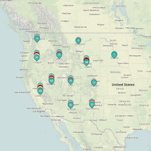
The time has come for a over of our mapping services to clear the way for further development of handy tools for our users. As such, this month we have rolled out a new map format to better allow our users to quickly peruse wind energy leases by disposition. In order to keep the maps as clutter free as possibly,…
Tag: survey
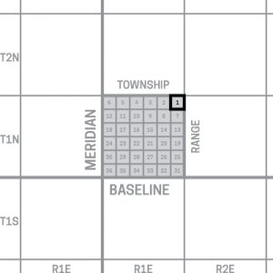
Understanding Location Data
Claims handled by the Bureau of Land Management are not mapped by latitude and longitude, as many maps now use. Instead, many of these claims harken back to an older form of surveying called the Public Land Survey System (PLSS), a measurement system that may seem confusing to the uninitiated, but was a great step forward in the time that it…